Word Maps
In its archives, the „Bayerisches Wörterbuch“ has more than 2,000 hand drawn word maps from the 1920s and 1930s. The large part were created by Eberhard Kranzmayer, some by Bruno Schweizer.
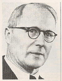
Eberhard Kranzmayer
Kranzmayer (*1897 Klagenfurt, †1975 Vienna) taught at the universities in Vienna, Klagenfurt and Munich. For quite some time, he worked on the Vienesse Academy of Science’s dialect dictionary project “Bayerisch-Österreichisches Wörterbuch”, and in 1964 became its editor in chief. From 1926 to 1933, he alternated half yearly between the dictionaries in Vienna and Munich and in 1937 became editor in chief of the Munich project, leaving in 1942 for Graz University. Kranzmayer is especially known for his historical phonology of Bavarian dialects „Historische Lautgeographie des gesamtbairischen Dialektraumes“ and for his study "Die bairischen Kennwörter und ihre Geschichte".
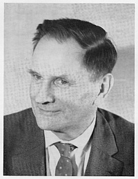
Bruno Schweizer
Schweizer (*1897, †1958 Dießen am Ammersee) was an expert on his own Lechrain dialect and on the dialects of the Bavarian and East Swabian areas. He also did research on Iceland, in the South Tyrol, and especially in the Cimbrian linguistic enclaves in Italy. In 1928, he started work in Marburg at the “Deutsches Sprachatlas” (German Linguistic Atlas), where he learned the handwork of linguistic cartography. He later found temporary employment at the “Bayerisches Wörterbuch”. Schweizers studies are still little known; his 1000-page Cimbrian Grammar, for instance, was only published in 2008.
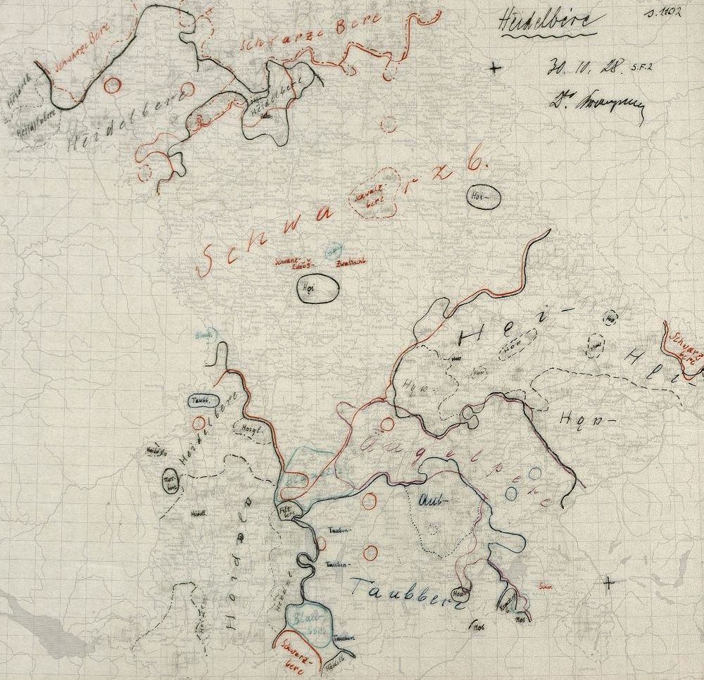
Kranzmayers Bavarian-Austrian Dialect Atlas
Kranzmayer planned a dialect atlas as a precursor to the planned dictionary. The maps are based on the material of the Field Exploration catalogue (Kundfahrtenkatalog) and the Dialect Geography questionnaire (Mundartgeographische Fragebogen). The archives of the Munich dictionary office contain 1558 orginal maps on oilpaper; 700 of them encompass Bavaria and Autria, 78 only Austria, and the remaining half only Bavaria. A few maps were actually prepared for publication, but the War prevented their publication.
Schweizers Atlas of Old Bavaria
Schweizer was already planning his dialect atlas in the 1920s. He did not include most of the Upper Palatinate on his maps, but did include parts of Swabia and neighbouring Austria. Several maps were prepared for print, but never published. The large part however consists of manuscript drafts.
Methodology
Kranzmayer’s maps are based on fewer locations than are Schweizer’s, and indeed in some regions have large gaps, obscured by the way the maps are drawn. Both atlasses are in the tradition of the German “Marburg” school of dialectology.
Legends
A few of Kranzmayer’s maps have legends, but maps with isoglosses are taken to be self-explanatory. The legends for Schweizer’s maps are on separate sheets which have not yet been scanned.
To view the maps, please click on the one you would like to open.
![[Translate to English:] Ausschnitt aus der Kranzmayer-Karte „Donnerstag” mit Legende](/fileadmin/user_upload/Files/BWB/07_Kranzmayer_K_71.jpg)